A large company where rainwater disappears into the sewer via the downspout in quantities of hundreds of liters at a time. A laundry in the same neighbourhood tries to use water as sustainably as possible but still has to rely on tap water during droughts. How great would it be if the laundry could use the lost rainwater from the large company to jointly benefit from water. With the WaterAtlas, which VITO is presenting today as part of the Flanders WaterProof project, the laundry can instantly see which companies in its neighborhood can contribute to a sustainable solution for its water needs. This way, we once again achieve a part of Minister Zuhal Demir's Blue Deal ambition to further close the water cycles.
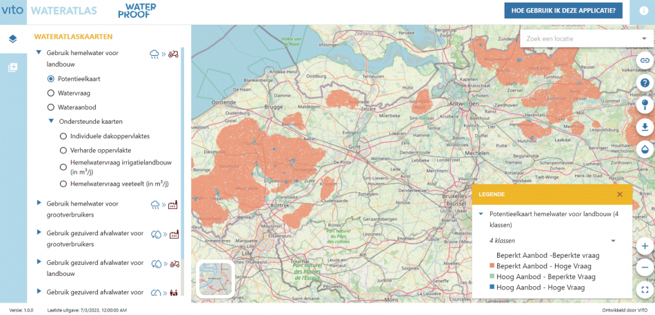
The WaterAtlas is an interactive map tool for Flanders that professionals, but everyone by extension, can consult for free and which provides insight into the potential of various alternative water sources. On wateratlas.be, maps make the match between a local alternative water source and a local water demand. These sustainable water sources can be both large-scale rainwater collection and treated wastewater. The local water demand can include households, businesses, and agriculture.
A good example is the fruit and vegetable industry. This offers huge potential to reuse treated industrial wastewater or rainwater for irrigation in nearby agriculture or horticulture. Everyone can check in their own region where there is high demand and high supply, and whether they can be matched.
Who, what, how much
Whoever consults the WaterAtlas also immediately gets all the background data. You see not only where exactly the alternative water sources are located, but also who needs water nearby. Concrete figures estimate how much rainwater each industrial site can potentially collect or how much irrigation water each agricultural or horticultural plot needs.
In this way, the WaterAtlas makes this spatial data available on a public platform for the first time. It clearly shows where water may be available in periods of drought. This way, the WaterAtlas accelerates the transition to a climate-robust Flanders and supports many local projects.
“If we want to protect ourselves against periods of drought - as we have already had to experience several times in recent years - a proactive policy is necessary. With the Blue Deal, we therefore want to strongly support initiatives like this. By clearly showing supply and demand, we can better protect ourselves against it. The WaterAtlas is therefore an initiative that is useful for every Flemish person, every Flemish company, and every Flemish city or municipality", says Flemish Minister of Environment Zuhal Demir.
The WaterAtlas was developed within the Blue Deal project Vlaanderen WaterProof at the request of Flemish Minister Zuhal Demir and was developed by VITO with partners based on feedback from water managers, spatial planners, and organisations rolling out specific water projects.


