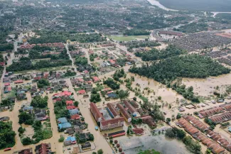
Climate resilience
Air pollution and climate change are serious threats to our health and our environment. VITO supports governments, industry and the private sector in making decisions to become climate resilient and to improve air quality. VITO provides services, decision support instruments, risk analyses and models so that our customers can take the best informed decisions to proceed to actions.
Our expertise
We quantify climate change impacts and assists in adaptation planning to shape a climate-resilient society.
To boost your climate resilience, we empower you against climate change impacts and facilitate decision-making, planning and adaptation strategies:
- we provide insights in climate change hazards and impacts in diverse sectors such as energy, agriculture, biodiversity, urban development and health;
- we translate raw climate data into ready-to-use information, actionable insights and adaptation plans that meet your needs;
- we keep track of global trends such as urbanisation, population growth, and land use shifts;
- we assist you with stakeholder engagement via interactive climate portals, citizen-science data collection, workshops and transition arenas to support program management and action planning;
- and we help shape policy frameworks as well as put forward efficient measures.
Our services
- Engage: Actively involving communities and policymakers to promote climate awareness and to foster dialogue and action towards climate resilience.
- Measure: Collecting precise data through innovative technologies to quantify atmospheric and environmental parameters.
- Model: Employing advanced simulations to assess the current climate, predict future climate and evaluate adaptation scenarios.
- Support: Providing crucial expertise to stakeholders, empowering informed decision-making for sustainable practices.
- Implement: Translating research findings into actionable data and practical solutions, facilitating real-world adaptation strategies.
Our products and services


Would you like to know more?
Feel free to reach out to Filip with all your climate-related questions. He'd be happy to help.

Our projects
Check our interactive world map showcasing the global reach of our research team's initiatives. Blue pinpoints highlight our urban-scale projects addressing heat stress, green pinpoints our national-level agricultural projects.