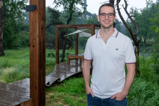
VITO employee in the spotlight: Daniele Zanaga
Daniele Zanaga (37) studied physics in Italy, but his doctoral research brought him to Belgium. At UAntwerpen, he spent many hours studying materials under the electron microscope. After obtaining his PhD, however, Zanaga broadened his scope, even literally. In early 2019, he started working as a data researcher at VITO’s Remote Sensing department. Together with his team, he is developing global land cover maps, essential for monitoring the ‘health’ of our planet.

‘With Remote Sensing you can feel the connection to the planet’
Although both involve observation, microscopic characterization of nanomaterials is still quite different from satellite monitoring of the Earth. How did you arrive at this switch?
‘After my bachelor’s and master’s degrees in physics at the University of Parma, I wanted to further specialise in nanomaterials research. The University of Antwerp is internationally highly regarded in this field, so that’s how I ended up in Belgium in 2014. I did my PhD research within the EMAT group at UAntwerpen, where the micro- and nanostructure of materials is studied with particularly powerful electron microscopes. There, I developed the skills I use today as a data researcher, such as analysing (image) data with algorithms and especially problem-solving. With this typically fundamental research (where I spent many hours peering through the microscope), it can take a long time before it turns into practical applications. I preferred to develop things that evolved more quickly into operational applications and that made me feel I could have a more positive impact.’
And so you went looking for that impact elsewhere.
‘After my PhD, I worked for almost a year at a start-up in Hasselt developing apps for heart rate monitoring. Although I was much closer to concrete applications there, I didn’t really feel at home in the biomedical world. Rather than human health, I am interested in the state of nature, and in the “health” of our planet. That too involves monitoring, and that is exactly what VITO Remote Sensing does.’
You work within the ‘vegetation team’. What exactly do you do?
‘Among other things, we develop global land cover maps. These show global land use, and changes in it, which is extremely important in monitoring climate and biodiversity, for example. The images come from European Sentinel satellites, among others. We analyse these with algorithms to ultimately arrive at a global overview map. Within the European Space Agency’s WorldCover project, we developed both for 2020 and 2021 a land cover map, each at a resolution of ten meters. This is a huge improvement compared to the data/maps that were available before (resolution at a hundred meters). This leap required a hundred times more data processing; so that was quite an achievement.’
For a global map, ten meters is very accurate, but in your doctoral research you worked at the level of nano- and even picometres. That is very small.
‘Indeed. Back then, I could almost zoom in on individual atoms. (laughs) Now I try that with individual trees. By the way, working with maps took some getting used to for me in the beginning. Now it feels nice to have a connection with the planet via remote sensing.’
ESA WorldCover provides new levels of detail in the field of land use and land cover and is used by researchers, businesses and policy makers to support sectors that are critical to our well-being, such as biodiversity monitoring, food security, carbon assessment and climate change.
You are also looking for new colleagues. Who exactly are you looking for?
‘We are looking for data researchers with typical skills such as problem-solving. At VITO, we already have more than 25 years of experience in processing remote sensing data for land cover and land use, among other things. We are looking forward to several new assignments to convert valuable data into objective and usable maps. This way we want to continue expanding our expertise and services.


