Simulating climate risks for cities around the world with the Urban Climate Simulator
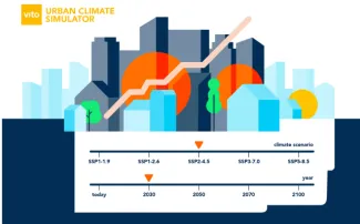
Many global climate risks occur in urban areas. Cities are vulnerable because of their high population density and infrastructure and the fact that they have their own climate, where extremes such as excessive heat and flooding are even more pronounced than in rural areas. Therefore, understanding and mapping climate risks is becoming increasingly important for cities around the world. That is why VITO has launched the Urban Climate Simulator: an online simulation tool based on the well-known UrbClim® software previously developed by VITO. The tool provides access to fast, detailed, high-quality information with high spatial resolution about a specific urban climate. This makes the Urban Climate Simulator the accessible solution for researchers, city and government officials, consultancy firms and development organisations that need this detailed data for their policy or research.

Urban Climate Simulator: new UrbClim® tool
This new configurator provides a low-cost and user-friendly way to obtain urban meteorological and climatological outputs, with very high resolution and for any city worldwide.
Filip Lefebre, Business and Relationship Development at VITO: 'To meet a regular demand for urban climate data, we developed the Urban Climate Simulator. In this way, we hope to help urban researchers and consultants, in exchange for a small fee that is needed to keep the service operational.'
A request in the tool initiates an UrbClim® climate scenario simulation on our supercomputer, which generates hourly spatial urban climate data according to the requester's specific requirements:
-
for any city worldwide
-
hourly data with a spatial resolution of 100-200 metres
-
for any time period and climate change scenario (IPCC) from 2001 to 2100
-
using one of the pre-selected land use specifications
On 3 October 2024, the Urban Climate Simulator was launched during an online webinar, where participants could learn about this new tool through a demonstration and some user cases that were presented. You can re-watch the webinar via this link: https://urban-climate.eu/resources
What data can you obtain with the Urban Climate Simulator?
Following a request in the simulator, the requested output from UrbClim® is processed and the requester receives a detailed quote for a specific data package with impactful indicators (health, biodiversity, energy and labour productivity) and visualisations (image files) such as temperature and heat stress indicators, among others, for the requested location and timeframe. The tool provides outputs in a standardised format for a series of specific indicators, but the UrbClim® team equally specialises in providing custom outputs with more or different details.


