GeoDynamiX - Spatial Modelling Tools
GeoDynamiX is VITO’s toolbox for the analysis, simulation and optimization of a wide variety of spatial issues in regions and/or cities with a view to support planning, policy making and sustainable development.
What we do
We offer our expertise as a service whereby we solve complex spatial problems by using spatial tools. We are also developing a number of products to efficiently execute spatial tools and models
Spatial Analysis
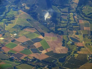
Discover new insights in the land use in your region based on detailed spatial data, spatial indicators and analyses of current land use and spatial patterns.
Simulation
What consequences do autonomous developments, policy choices and expected (international) trends have on future land use in your region? Discover the expected and intended land use changes in your region by using spatial simulations
Optimisation
Where are the best locations for the development of business parks, infrastructure, energy production installations, green areas, etc…? Search for the optimal locations based on spatial optimisations.
How we deploy our tools
- We solve complex spatial problems by using three types of spatial tools: analyses, dynamic simulation and optimization.
- We set up extensive spatial data to integrate data from a wide range of data sources to support our spatial tools
- We make data and results accessible in various ways depending on the client needs
- We apply our expertise and tools in multiple and multidisciplinary problems
- We connect with complementary (thematic) models
- And we cocreate new integrated models
Spatial issues
- How will settlement area, land use and land cover evolve between now and 2060 as a result of autonomous developments, external drivers, or, actual and potential policies?
- Which vision and goals do we favour when developing urban and rural areas, and, how will we realize them in the short, medium and long term?
- How do we capture qualitative concepts such as 'sustainable land use', ‘economical land use', 'environmental quality', 'land resource efficiency', 'development potential',' land resource efficiency potential', …, into measurable, quantitative spatial indicators?
- Which policy measures are most efficient to realize our policy goals? Where do we apply them, and, when is the right moment to act?
- What are the best locations for the development of new industrial estates, infrastructure, distributed energy production, protected nature areas, facilities, …?
- Where are the dangerous hotspots in the transportation networks for specific groups in our population, such as: children, elderly, those walking or cycling? What about the exposure of particular species of our fauna? Which technical measures and infrastructure are to be implemented?
GeoDynamiX products
Spatial data
(Spatial) data is gathered in function of the studied challenges. In-situ data accurately and up to date represent local land use related aspects. Both in-situ data and open source data e.g. from local (high resolution commercial imagery) to global (low resolution) remote sensing images can be processed and combined with each other to ensure a solid database on which spatial analyses are built.
Simulation Tool
The Simulation Tool is the original core of GeoDynamiX. It has been developed to forecast and map changing land use at high spatial resolutions. This tool is used for the spatial interpretation, computation and visualization of scenarios: both what-if scenarios and contextual scenarios.
Optimisation Tool
The Optimisation Tool is a spatially-explicit model that is used to solve spatial optimization problems such as determining locations for new business parks or for nature areas, taking into account physical and ecological preconditions, as well as economic and social costs and criteria.
ZoekZoneModel
The ZoekZoneModel searches for the ecologically most suitable locations, within the framework of the legislation and taking into account socio-economic parameters. The ZoekZoneModel is used in a participatory process with a large number of stakeholders. The model is therefore constantly being refined in consultation with the stakeholders.
Defragmentation Tool
The Defragmentation Tool is a practical deployable software instrument that offers a modeling approach to map potential defragmentation locations and to quantify the effects of defragmentation on habitats (migration, foraging and breeding habitats) of species. Thanks to this tool and its results, targeted and efficient defragmentation measures can be rolled out.
GDX Scripting Tool
The GDX tool is an instrument intended to automate complex spatial operations and calculations. It consists of an extensive library of algorithms implementing spatial operators, and, a nearly human computer language to build scripts for the sequential execution of the algorithms. It is used extensively for the computation of complex spatial indicators.
Founding fathers
Spatial challenges are not limited to a single administration, policy level, knowledge domain or specialism. They cut right through all these classical divisions. GeoDynamiX is therefore also used by users within various administrations, at the national, regional and local level. In addition to policy choices, our decision support tools are also used to support strategic choices made by private companies.
In order to maximize the exchange of knowledge and to facilitate the use and management of GeoDynamiX, the developers and users are united in the so-called Founding Fathers of GeoDynamiX.
Would you like to know more about GeoDynamiX?
Feel free to contact Karolien. She will be happy to tell you more about all of GeoDynamiX' tools.