Water-secure Moerbeke-Polder: Building a Robust Water System Together
In early March, the launch event of the LEADER project Water-secure Moerbeke-Polder took place. In this border area between Flanders and the Netherlands, we are working across borders with local governments, farmers, water managers, and other stakeholders towards a shared ambition: a water system that is more resilient to both drought and flooding.
The challenges in the Moerbeke-Polder are recognisable: periods of extreme drought alternate with peak discharges and flooding. At the same time, the demand for sufficient and quality water for agriculture, nature conservation, and drinking water production is growing. In this project, we are investigating how we can manage water more intelligently by retaining, delaying discharge, infiltrating, buffering, and utilizing it, while respecting the specific characteristics of this unique area.
Starting from the potential
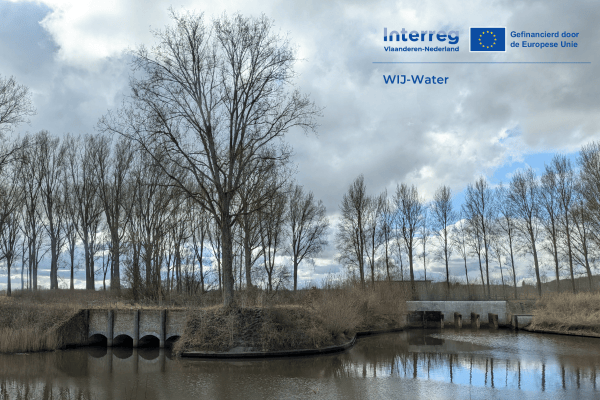
The Water-secure Moerbeke-Polder project focuses on strengthening water security and climate resilience in a unique border landscape where the Moervaart depression, the Maldegem-Stekene sand ridge, and the Zeeland creeks are hydrologically connected. This interplay of geomorphology and historical land use offers opportunities to retain water. The project builds on previous initiatives such as The Dry Delta and Aquatuur, where the potential of the sand ridge and nature areas, focusing on creeks as water buffers, has already been partially explored. The ambition is to further substantiate these insights with measurements and analyses and translate them into concrete measures supported by a strong regional coalition of local and supra-local actors.
Thematic field laboratories at the centre
The project develops this through two thematic field laboratories that function as experimental spaces in co-creation with stakeholders. Field lab 1 focuses on the dynamic management of surface water levels in the area of Pereboomsgat, aiming to find a better balance between nature and agriculture and to better understand the impact on groundwater. Field lab 2 focuses on the activation of the Oostvaart and promoting infiltration in the sand ridge to enhance water storage and availability. In both field labs, similar steps are followed: a stakeholder analysis and participatory process, a thorough analysis of the area and water system, the preparation of concrete measures, monitoring of possible effects, and laying the foundation for a future vision together with the regional coalition.
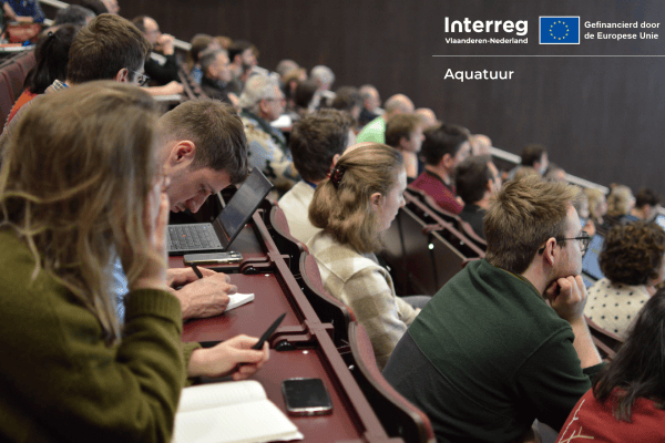
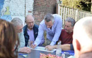
Strong start with interactive workshops in the field
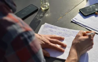
The project kicked off with an interactive workshop about the Pereboomsgat and the Oostvaart field labs. The large (local) turnout and involvement show how important the theme is in the region. During the sessions, participants discussed three central questions: what do we expect from this process, where are the opportunities and obstacles in the area, and how can we best monitor the water system?
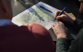
Regional Knowledge as a Key to Targeted Solutions
An important part of the workshops was mapping local knowledge. Participants indicated very specifically which areas they experienced as too wet or too dry. It was remarkable that there was a broad consensus about this. These insights form a valuable basis for developing targeted measures and drawing up integrated water management strategies. Practical points of attention also clearly emerged. Consider the operation and adjustment of weirs, the drainage of lower-lying plots, and the impact of height differences in the area. In addition, the importance of water quality was emphasized: without addressing discharges and sewerage, water reuse is not straightforward.
Furthermore, broader conditions were also considered, such as the influence of drinking water extraction, the protection of heritage along the Oostvaart, and the need for coordination on water management across the national border.
Measuring is Knowing: Start of an Extensive Monitoring Network
To answer the questions of local regional stakeholders, a comprehensive network of observation wells and sensors will be rolled out in both field labs this spring. These will continuously measure groundwater levels and water quality, providing data that will be available via an online dashboard. During the workshops, the proposed monitoring network was critically examined together with the participants. It became clear how important it is to carefully choose measurement points: representative of the system but also practically feasible in the field.
This combination of data and local knowledge forms the basis for better understanding the water system and for analysing and testing measures in practice.
Together Towards a Climate-Resilient Polder
The first workshop made clear that there is a lot of knowledge, involvement, and willingness to collaborate in the (border) region. At the same time, the complexity of the water system and the many interests converging there were also highlighted. Water-Secure Moerbeke-Polder therefore strongly focuses on co-creation: learning, testing, and adjusting together. The insights from the workshops form an important first step in this process. In the coming months, we will continue working with measurements, analyses, and the development of possible measures, always in close dialogue with the stakeholders involved.
The Water-Secure Moerbeke-Polder project is funded by LEADER, with additional co-financing from the local governments of Lokeren and Stekene. The project is carried out by Moerbeke-Polder, Regionaal Landschap Schelde en Durme, and VITO.