UrbClim: limit the climate risks in your city
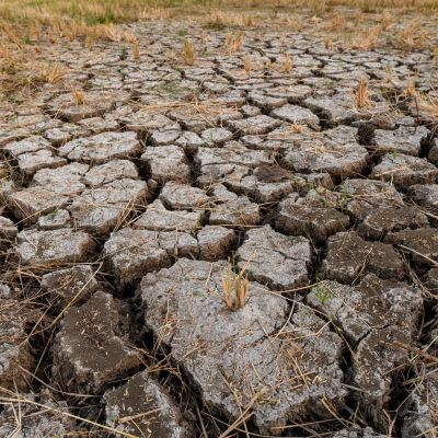
Cities experience twice as many heat wave days as their rural surroundings. By predicting the impact the climate will have on a city, local policymakers can take concrete measures to limit climate risks. The UrbClim-model was developed by VITO to help you make these predictions.
Accurate climate models for cities
UrbClim specifically generates accurate climate models for cities. The model solves a set of simplified prognostic flow equations for the atmospheric boundary layer and contains detailed urban surface physics. With the output of several meteorological parameters (such as temperature and wind speed), UrbClim calculates the amount of heat wave days or cooling degree days in a city.
Valuable insights to help you take concrete measures
The insights of the UrbClim-model can be used in several ways. For example, it gives local policymakers an objective evaluation of the presence and intensity of the urban heat islands in their cities.
Moreover, it can give you daily forecasts of the heat stress conditions in your city, allowing you to react quickly. It also helps you to discover how green/blue measures affect your urban climate.
VITO’s UrbClim-model
- Is almost twice as fast as other traditional ‘urbanised’ mesoscale atmospheric models.
- Is unique in its ability to simulate long periods at high spatial resolution – at an affordable computational cost – while not compromising on accuracy.
- It is one of the few models worldwide that are capable of conducting simulations of sufficient length (decades), nested in an ensemble of large-scale climate models.
Would you like to know more about the UrbClim-model?
Let’s find out together how we can limit the impact of climate risks on your city. Contact Filip Lefebre today.

Frequently asked questions about the UrbClim model
The UrbClim model can help anyone who:
- wants to assess the urban climate of an entire urban area at once;
- wants to develop data-based urban adaptation strategies and action plans, to make decisions based on science.
- wants to increase awareness of the effects of climate change in urban environments.
The UrbClim model is the result of protracted development. Today, it has already been used successfully in many cities worldwide (Almada, Antwerp, Barcelona, Berlin, Bern, Bilbao, Brussels, Delhi, Ghent, Hasselt, London, Paris, Prague, Rome, Skopje, Tilburg and Vienna).
UrbClim is also used in several projects for local, regional, national and international organisations.
A large share of global climate risks is concentrated in urban areas. Cities are vulnerable because of the high density of people and the infrastructure. In addition, urban areas shape their own climate, amplifying climate extremes such as excessive heat and flooding.
Visit www.urban-climate.eu for more information about the UrbClim model or read De Ridder, K., D. Lauwaet, and B. Maiheu, 2015. UrbClim – a fast urban boundary layer climate model. Urban Climate, 12, 21-48.