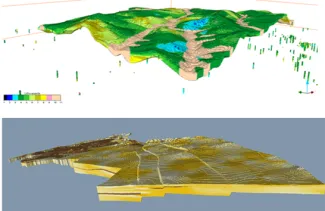
3D geological modelling
3D geological modelling is a technique for creating 3D representations of the underground based on geological and geophysical observations and concepts. It is used for managing and quantifying natural resources, with applications such as groundwater, geothermal and coal exploration.
Meet VLAKO
The Flemish Knowledge Center of the Subsoil (VLAKO) is a Task Force within VITO that conducts policy-supporting research for the Flemish Government.
VLAKO carries out various research tasks:
- 3D (hydro)geological mapping (geological and hydrogeological layers and faults) of Flanders and beyond
- Resource (raw materials) mapping
- Geological data collection and management in the context of the Geosciences Database of Flanders (DOV)
Our services
- Policy support
- Subsurface applications (geothermal, groundwater, mining, …)
- Reserve estimations of subsurface resources
3D modelling
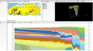
3D geological and hydrogeological models
3D voxel models for raw materials (loam, gravel and sands)
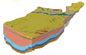
3D Cross-boundary (hydro)geological models (H3O-Roer Valley Graben, H3O-Campine area)
More information
Want to know more about 3D geological modelling? Feel free to contact Jef.