Buildings that are no longer in use, ready for renovation or demolition, still contain many useful elements. Now they are usually disposed of as rubble. But what if we could estimate in advance what materials might be present in a building to be demolished? What if we could look at building materials already present in the city as an 'urban mine', ready to be mined? VITO has brought together its expertise in materials management, data analysis and remote sensing in a project for automatic materials recognition. With the help of data science and based on existing images from Google Street View, the Demolition Guide makes an analysis of what is still usable or recyclable, or can be restored.
Mol, 7 December 2021 - The time when we used raw materials to make a product that was thrown away after use is over. In a circular system, we try to focus entirely on reuse, recycling and repair. To do that properly, we need to know exactly what materials are available.
"The construction sector and the built environment are the largest material consumers worldwide and represent the highest share of our Flemish waste production. In the Demolition Guide project we have been evaluating how we can use data science to support or even accelerate this transition”, says Yoko Dams, R&D expert circular materials management.
Windows and building types
To know what material stock is available in the built environment, we not only need to know where and when these materials will be released, but we also need to be able to precisely list the materials in question. In order to map this material stock quickly and effectively, VITO and Immoterrae launched a demonstration project in 2019. "We focused on windows and building typology. This focus on windows has everything to do with their broad application in the context of circular economy. Windows can be reused or recycled and they allow us to estimate the energy efficiency of a building. Building typology, on the other hand, gives us a picture of the use of brick, hidden brick and whether it is a residential or non-residential building. When we put those elements together, we get a better idea of the average materials used in that whole building."
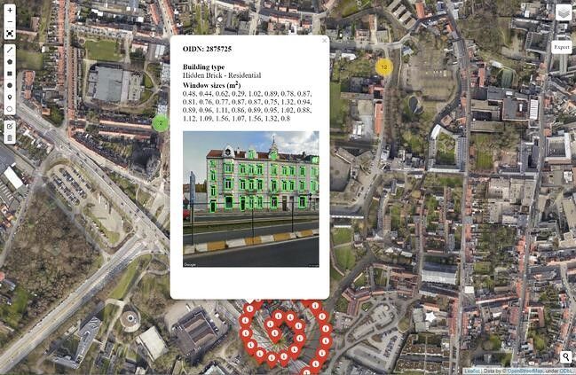
Automatic material recognition was applied to some buildings in Leuven. The results were made available via an interactive map. "We first focused on the windows and we achieved an average accuracy of 85% there," says Yoko Dams. "In addition, we used three AI models for building typology recognition. We trained them on a dataset of hundreds of facades in a number of Flemish cities. The result is an accuracy of 90% for all models and a score of 95% for brick."
At the end of the process, an estimate was also made of the residual value of the windows based on the asking prices of used windows on online trading platforms. This took into account all the properties that determine the price of windows: size, type of profile, type of window and type of glass.
The Demolition Guide has a lot of potential
The Demolition Guide has passed its first test. It is possible to detect building elements and materials on street images of buildings in Flanders. In a relatively short time, this system can also be deployed at district or city level. If the Residual Value Estimator is further expanded, more materials can be detected and estimated.
Want to know more?
Read the blog post on VITO's Remote Sensing website.
This project was funded by OVAM – Circular Flanders and carried out by VITO Remote Sensing and VITO Materials in collaboration with partner Immoterrae. We thank the stakeholders in this project, City of Leuven, BOPRO, Tracimat and FLOOW2, for their valuable contribution from the end-user perspective.


