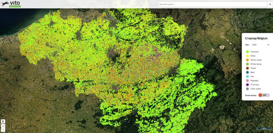
An overview of the Belgian agricultural landscape
For the third year in a row, we produced a yearly cropmap for Belgium. The cropmap shows the main crop type on each individual field cultivated in the 2020 growing season and is openly available via an interactive online viewer.
Just as in 2018 and 2019, we deployed our automatic field boundary detection tool based on Sentinel-2 imagery and a convolutional neural network to precisely delineate the fields, followed by a recurrent neural network approach to recognize crop types based on joint time series of Sentinel-2 optical imagery and Sentinel-1 radar backscatter. Kristof Van Tricht, our remote sensing expert in agricultural monitoring, explains more about this technology in his blog article ‘A Sentinel shake for early crop mapping’.
"Multi-year detailed crop mapping experiments in a country as smal as Belgium still yields a wealth of experience for global approaches such as in the worldcereal project."
Thanks to abundant training data over the years such as the Land Parcel Identification System, in combination with state of the art deep learning technologies, we are able to reach accuracies of >90%. In addition, our classification algorithms get smarter every year as they get to see more and more variability in growing seasons and agricultural practices making them ever more robust.
By producing a consistent cropmap each year, we are able to get better insights into the dynamics of the agricultural landscape, including crop rotation cycles and parcel boundary changes. And at the same time, our crop type mapping approaches can be finetuned and applied in regions around the world.


