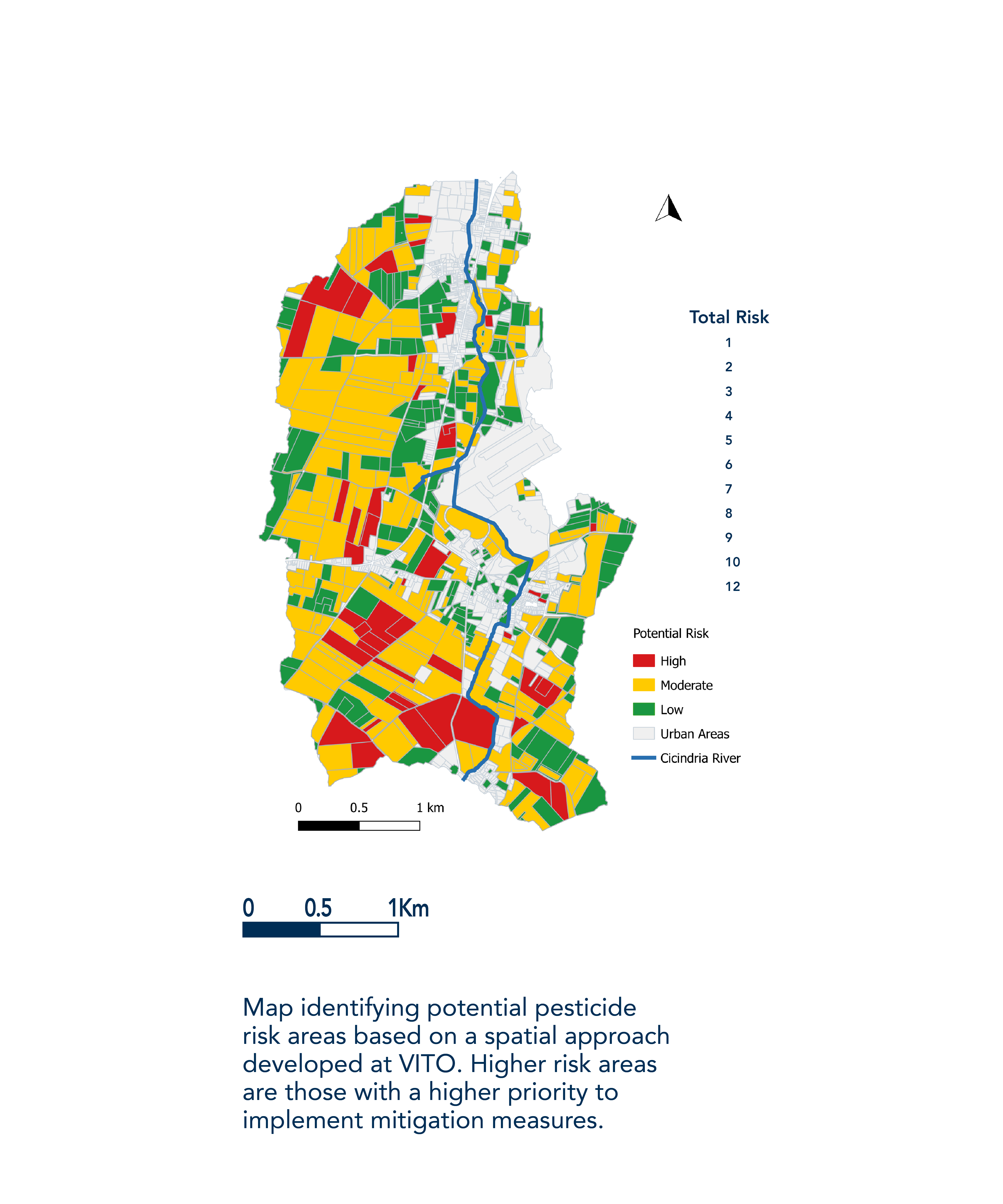
A spatial approach to identify priority areas for pesticide mitigation
IDENTIFICATION OF PRIORITY AREAS TO SET RISK-BASED MANAGEMENT PRACTICES FOR PESTICIDE POLLUTION MITIGATION
A spatially explicit model-based approach was developed to detect priority areas for diffuse pesticide pollution at catchment scale. The method uses available datasets and considers different pesticide pathways in the environment post-application. The approach was applied in an agricultural catchment area in Belgium as a case study. Risk areas were identified using detailed landscape data and combining pesticide emissions and hydrological connectivity. The tool helps to prioritize zones and detect particular fields to target landscape mitigation measures to reduce diffuse pesticide pollution reaching surface water bodies. The spatial approach represents an initial step in a decision-support framework to establish cost-effective measures to mitigate pesticides as part of a catchment management strategy.

- Enhanced analytical skills
- Problem solving and critical thinking
- Maintaining a steady workflow under pressure
- Planning and organizing work in multicultural teams
- Concise reporting and clear communication of results in academic and business environments
- Improved programming skills

- Profound understanding of environmental issues in agriculture
- Practical solutions to complex problems involving multiple stakeholders with diverging interests
- High adaptability to changing environment
My aim is to bring relevant environmental solutions for sustainable intensification of agriculture.


